formation and geology
Petroleum typically forms from marine plant and animal organic matter that accumulates in depressions along marginal marine
environments (5). Initial microbial removal of oxygen and nitrogen followed by thermal alteration from subsequent burial by rock, silt, and sand is the primary mechanism for liquid petroleum formation (5; 12). The Laramide orogeny, which formed the
Rocky Mountains 70 million years ago, introduced pressures that forced existing petroleum in southern Alberta to migrate north and east into existing sand deposits from ancient river beds (5). The petroleum is believed to have absorbed into existing sand where it underwent alteration through oxidation, biological degradation, and loss of volatiles, forming bitumen (5; 12). Each sand grain is covered by a thin water envelope and a film of bitumen, which occupies pore spaces (1). The composition of the Athabasca oil sands is approximately 70% sand and clay, 10% water, and 0% to 20% bitumen (5).
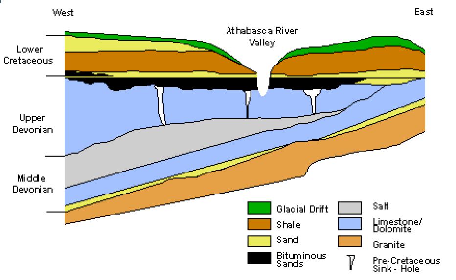
Figure 1-6:
Geological cross-section of the Athabasca oil sands (5).
|
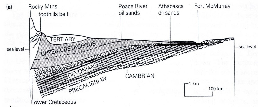
Figure 1-7:
Geological cross-section of Alberta (5).
|
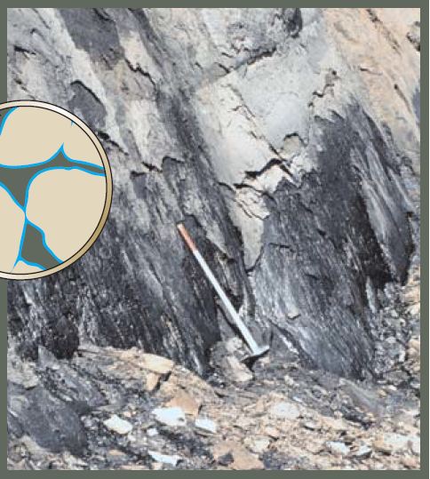
Figure 1-8:
Bitumen seeping out of an Athabasca oil sands outcrop approximately 50 km north of Fort McMurray (1).
|
The mineable extent of the oil sands is overlain by no more than 75 meters of overburden consisting of – in order from the ground surface – boreal forest, wetlands and muskeg (i.e., peat bog), glacial drift, clay and unconsolidated sand, and Lower Cretaceous shale (Figure 1-6). Bitumen deposition is mostly present in the McMurray Formation, an argillaceous, moderately sorted and fine-grained
Lower Cretaceous quartz sandstone. This unit is underlain by a Devonian limestone angular unconformity followed by Cambrian limestone and a Pre-Cambrian granite basement (5, 13) (Figure 1-7). The McMurray Formation has a maximum thickness of 150 meters. However, areas containing bitumen saturation have an average thickness of 60 meters (14). The McMurray Formation outcrops 50 km upstream of Fort McMurray where bitumen leaching from the outcrop is frequently observed (15) (Figure 1-8).
Studies of rock strata in this area have concluded that the McMurray Formation accumulated in incised fluvial valleys and subsequently flooded by transgressing marginal-marine environments of the early Cretaceous (13). In general, McMurray facies are a continuum of sedimentary environments from fluvial at the lower layers (early Cretaceous), to marginal-marine, estuarine in the middle, to marine shoreface, deltaic at the upper layers (late Cretaceous) (13).
